From Piano delle Alpi to Rifugio Prabello
This excursion leads to one of the historical refuges of the Larian mountains, the Prabello.
It takes place along easy tracks and paths and is suitable for families with children.
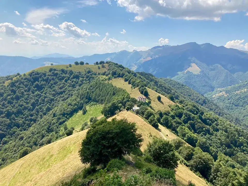
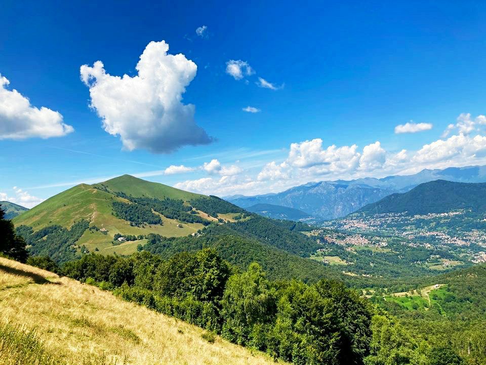
From Pian delle Alpi you reach the Prabello Refuge through mule tracks in the woods and paths surrounded by larch trees. From Prabello the view of Val d’Intelvi is wonderful, behind it remains the peak of Monte Generoso; down from the western side you can see the wooded valleys of the Mendrisiotto, in Switzerland.
- Vertical drop: 240 metres (450 metres to the top of Sasso Gordona)
- Equipment: Simple hiking boots.
- Duration: 50 minutes (1.30 to the top of Sasso Gordona)
How to reach the starting point: Pinao delle Alpi
Leave the Statale Regina road 340 towards the end of Argegno, turn left and take the provincial road that leads to the Valle d’Intelvi through the villages of Dizzasco, Castiglione Intelvi and S. Fedele Intelvi.
Then take the provincial road on the left towards “Casasco-Erbonne”.
After the village of Casasco you have to continue until Alpe di Cerano (Piano delle Alpi) where you can leave your car, near a picnic area.
The route to the Prabello Refuge
A sign indicates the refuge on the left. After crossing a meadow you reach a forested path where there is a sign with the following indications:
- Prabello Refuge 0.45 minutes
- Cernobbio 5.45 hours
- Ermogna 0.30 minutes
- S. Fedele 3.30 hours
From the indications you can understand that ypu are on the Via dei Monti Lariani, take the path towards “Rifugio Prabello – Cernobbio”.
You enter the woods and start an uphill path, after a right bend and a subsequent left bend you continue on level ground.
After crossing the plateau you will find yourself in front of a crossroads, a red and white sign placed by the CAI Monteolimpino indicates the direction to the Prabello Refuge.
Continue along the path first with a little slope and then uphill. Once you have passed a bend on the left you will reach a flat stretch. Keeping to the left you will see a sign indicating the Prabello Refuge (1025 m.).
You proceed slightly uphill along the path until you reach a new fork where another red and white sign indicates the refuge to the left.
The path starts climbing again, always following the flag signs indicating the path n.1, ignoring the small paths that detach from the main one.
Proceeding along the path little by little you begin to catch a glimpse of the refuge.
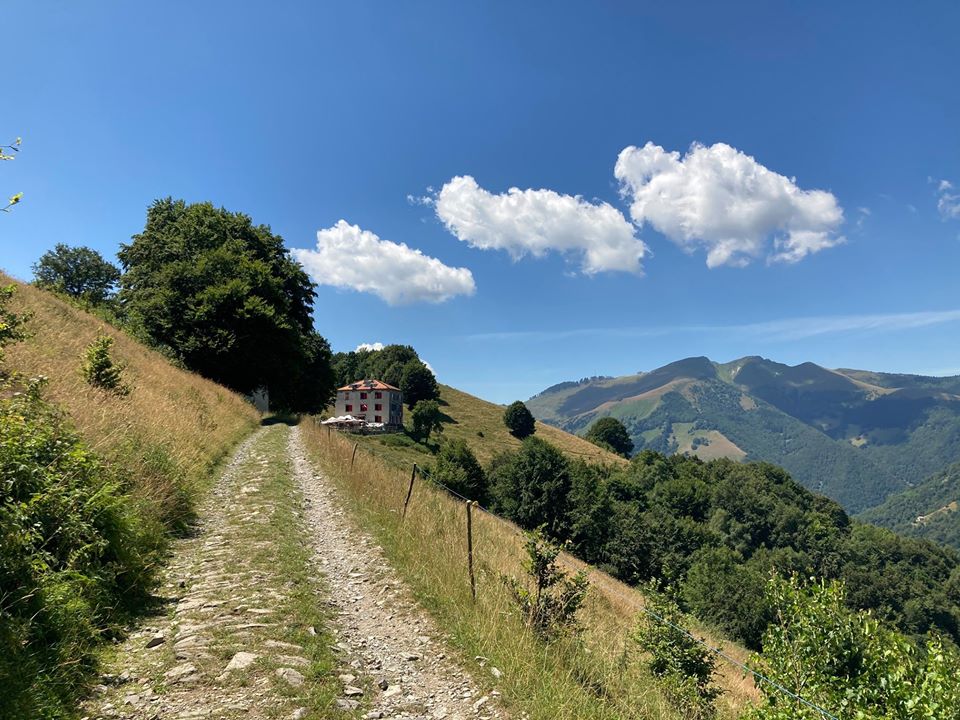
The path in the woods lasts about 35 min, in short, once you arrive at Pian delle Alpi and cross the meadow, you have to take the path in the direction of “Rifugio Prabello” and follow the red-white signs (path n.1 of Via Dei Monti Lariani).
Excursions starting from the refuge
- to Vetta del Bisbino (1325 m) 2 h 45 min
- to Rifugio Bugone (1119 m) 2 h 10 min
- to Monte S. Bernardo (1351 m) 1 h 10 min
- to Monte Colmegnone (1383 m) 1 h 30 min
- to Rifugio Murelli (1200 m) 1 h 30 min
- to Sasso Gordona (1410 m) 40 min
- to Rifugio Binate (1200 m) 50 min
- to Poncione di Cabbio (1262 m)
From Rifugio Prabello to Sasso Gordona
Once at the refuge, after a break, if you wish, you can continue the climb towards Sasso Gordona.
After passing some huts you will take an uphill path. Initially you proceed along the ridge of the mountain with a slight slope, near the summit the path has some “rocky passes”, but you can help yourself with the support of chains placed on the path.
The last part of the climb is the steepest, but easy to tackle thanks to the use of the increasingly frequent support chains.
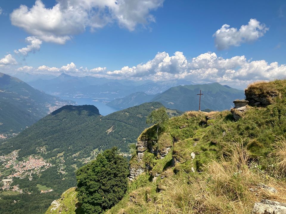
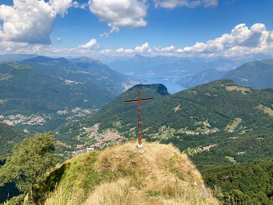
In the last meters you walk along a small ridge that leads to the cross of the mountain from which you can enjoy a beautiful panorama.

Rifugio Prabello
The Prabello Refuge is located in the province of Como and is on the watershed between the Intelvi Valley and the Muggio Valley on the border between Italy and Switzerland. It stands on a beautiful natural terrace, always in the sun, and surrounded by an enchanting landscape that sweeps towards Lake Como, Bellagio, Legnone, Grigne, the Larian mountains, Monte Generoso, Monte Croce and far away Pizzo Badile, Pizzo dei Tre Signori and Bernina.
Passage point of the “bricolle” (coarsely stitched jute bag, usually used to transport smuggled goods crossing the Italian-Swiss border) and former barracks of the Guardia di Finanza is now one of the stage point of the Via dei Monti Lariani which crosses the mountains on the western shore of Lake Como from Cernobbio to Sorico (125 km).
Sasso Gordona
Around the mountain and on its summit there are several fortified works, never used for military purposes, dating back to the First World War, which were part of the Northern Frontier, the defensive system popularly known as the Cadorna Line.
Under its northern side passes the Via dei Monti Lariani.
From the top, which can be reached with moderate difficulty despite the ruggedness of the mountain, you can enjoy a wide panorama, especially of the Lake Como.